Regione britannica
- Regione britannica
- Gran Bretagna: monti e pianure
- Gran Bretagna: fiumi, laghi e coste
- Gran Bretagna: ordinamento dello stato
- Gran Bretagna: Capitale e Monumenti
- Gran Bretagna: città
- Gran Bretagna: settore primario
- Gran Bretagna: settore secondario
- Gran Bretagna: settore terziario
- Gran Bretagna: piatti tipici
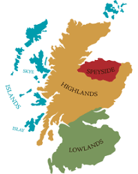
- Gran Bretagna: Scozia
- Gran Bretagna: Irlanda del Nord
- Gran Bretagna: Galles
- Nuova pagina
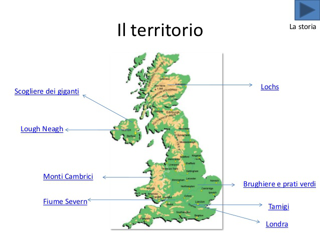
grafico composizione territorio britannico.
 Posted by
giulia e loris
Posted by
giulia e loris
PIANURA
SUL TERRITORIO DEL REGNO UNITO PREVALGONO PIANURE LEGGERMENTE ONDULATE E BASSE COLLINE.LE PIANURE PIU' VASTE SI TROVANO IN INGHILTERRA E PRENDONO IL NOME DI: MIDLANDS E LOWLANDS SONO UNA FASCIA PIANEGGIANTE.
Posted by
Loris e Giulia R.
MIDLANDS
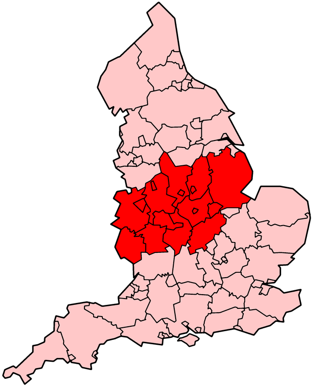
POSIZIONE GEOGRAFICA
Posted by
Loris e Giulia R.
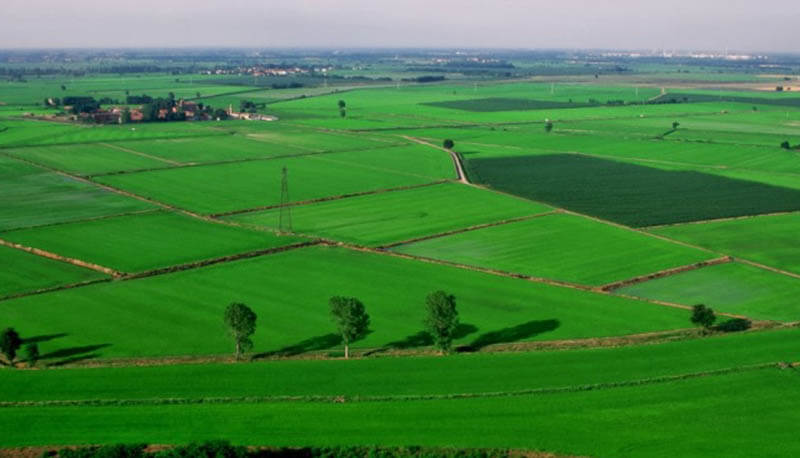
MIDLANDS
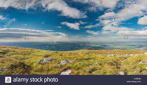
IMMAGINE DELLA PIANURA
Posted by
Loris e Giulia R.
LOWLANDS
POSIZIONE GEOGRAFICA
Posted by
Loris e Giulia R.
LOWLANDS
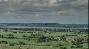
IMMAGINE DELLA PIANURA
Posted by
Loris e Giulia R.
MONTAGNE
LE MONTAGNE PIU' ELEVATE SI TROVANO IN SCOZIA. PIU' A SUD TROVIAMO I MONTI PENNINI.
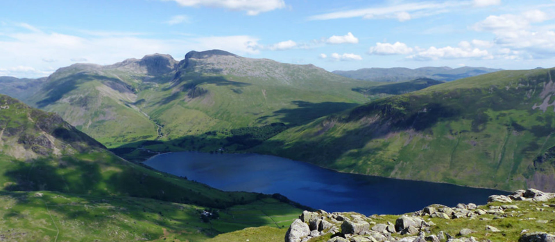
Abbiamo un immagine del monte Scafell Piche .Lo Scafell Pike, con un'altezza di 978 m, è la montagna più alta dell'Inghilterra. Fa parte della catena montuosa Southern Fells, situata nella contea inglese di Cumbria all'interno del "Lake District. Da non confondere con la montagna più alta del Regno Unito: Ben Nevis
Posted by
giulia e loris
BEN NEVIS
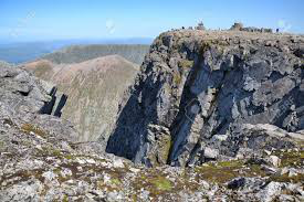
MONTAGNA PIU' ALTA DEL REGNO UNITO
Posted by
giulia e loris